
An important lesson from the Iran–US–Israel standoff is that control over a strategic chokepoint can make the effects of war felt far beyond the immediate theatre. As the world awaits an end to the impasse over the Strait of Hormuz, the focus now shifts to India’s eastern coast and the Bay of Bengal, where not just another vital maritime gateway – the Strait of Malacca – has seen constant great power anxieties, but also an impending race to gain strategic advantage in its rapidly transforming maritime landscape. While the littoral states are substantially investing in their maritime infrastructure, including deep-sea ports and transhipment facilities, the great powers are also increasingly seeking to establish their imprint and leverage over the Bay of Bengal. In this first of a series on the region, Shaoni Guha Mazumder and Tapas Das provide a holistic survey of the expanding port infrastructure in the Bay of Bengal littoral expanse, and their potential strategic ramifications.
Home page image: Naval vessels from the US, India, Japan, Australia and Singapore as part of Malabar 2007 Naval Exercise; photo credit - Wikimedia Commons
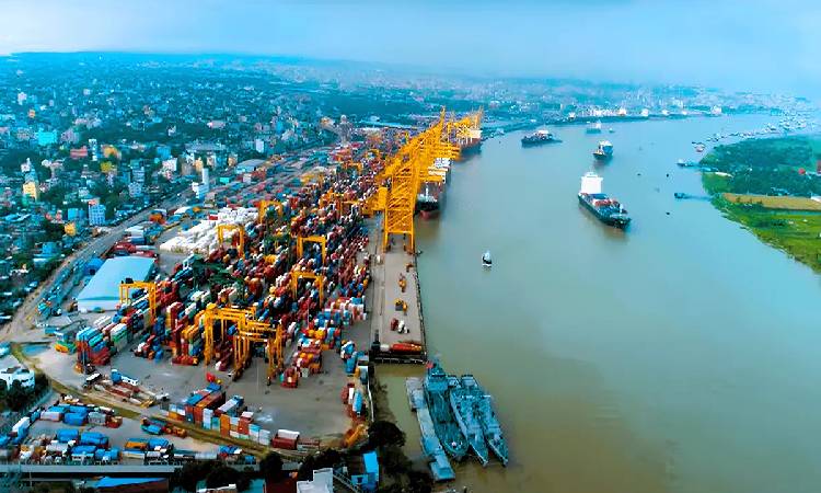
Text page image: An aerial view of the Chittagong Port; photo credit: Chittagong Port Agent
Banner image: A night aerial view of the Yangon Port; photo credit: Myanma Port Authority
The geopolitical landscape of the Bay of Bengal has evolved as a critical maritime frontier where major powers use port infrastructure to secure trade routes and project maritime influence. It serves as a vital link between the Indian and Pacific Oceans.
The Bay of Bengal is a large, triangular-shaped body of water with an area of approximately 2.1 million square kilometres, situated to the east of India and extending into Southeast Asia. Its importance as a sea business route is defined by its role in global energy security, regional trade integration, and its strategic position along the world's busiest shipping lanes.
While over 90 per cent of global trade takes place by sea, more than 80 per cent of maritime oil trade occurs in the Indian Ocean. Over 95 per cent of China’s trade with the Middle East, Africa, and Europe also goes through the Indian Ocean, while more than 70 per cent of India’s total maritime trade goes through this oceanic stretch.
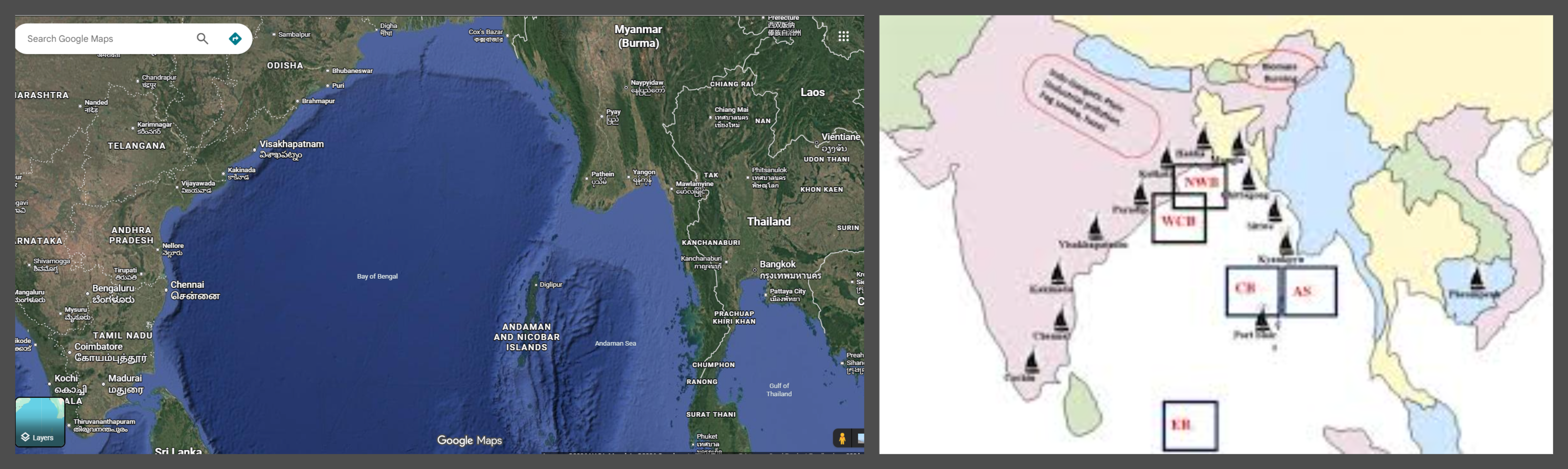
A Google map view of the Bay of Bengal and its littoral states (left), and map of major ports along the Bay of Bengal (right)
On the one hand, for the littoral nations like India, Bangladesh, Myanmar, Sri Lanka, Thailand, and Indonesia, the Bay of Bengal is the engine of regional economic growth. On the other hand, its eco-geopolitical location makes the region a hub of strategic power play, where controlling the ports has become important for the major powers.
Below is a country-wise assessment of how the region’s littoral states approach the phenomenon of the Bay of Bengal, its strategic as well as politico-economic dimensions.
Bangladesh
Bangladesh has its own perception of the region, derived from its historical legacy as part of the greater pre-partitioned Bengal of the historical, civilisational Indian subcontinent.
Its location at the apex of the Bay of Bengal, named after ancient Bengal, gives it a strong advantage in the region and serves as a hub connecting the Western and Eastern hemispheres and the Indian Ocean with the Pacific.
Multiple important ports in Bangladesh are not only the backbone of Bangladesh's monetary supply chain but also make it a crucial player in strategic power play. One of the major ports is Chittagong Port.
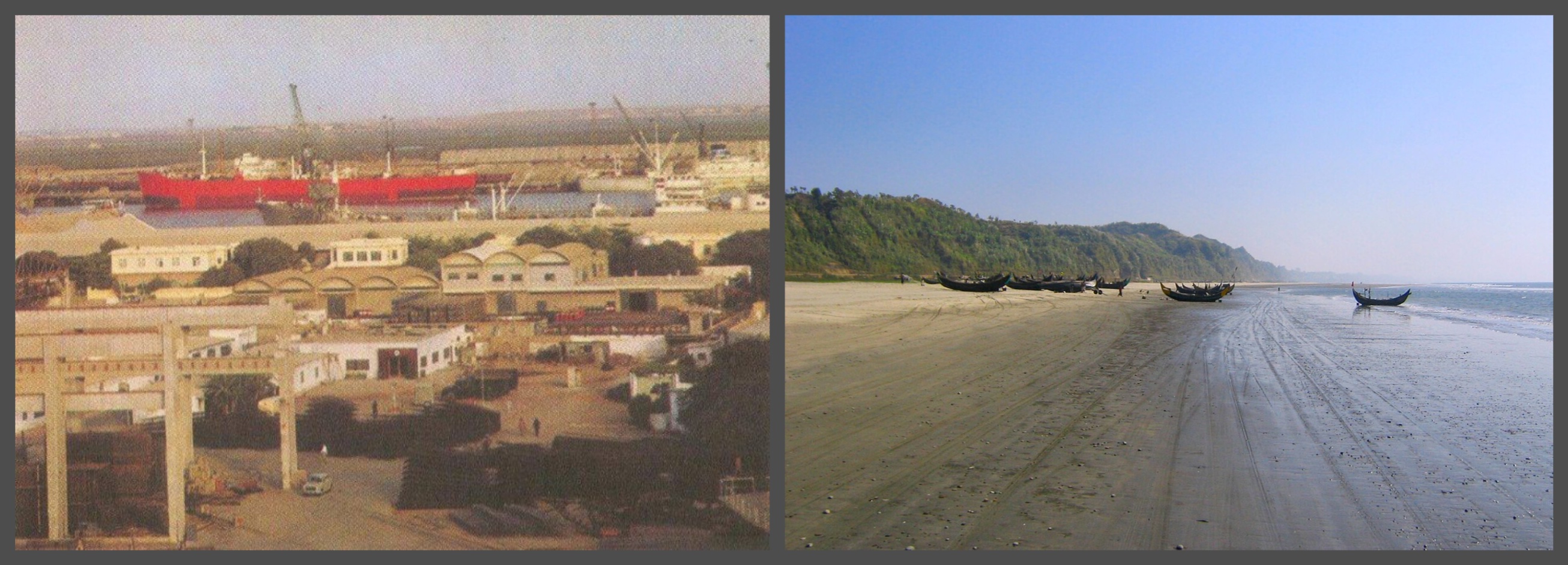
The Chittagong Port in 1960 (left); photo credit - James Burke, Cox's Bazar, the longest stretch of beach in the world (right); photo credit - Wikipedia Commons
Chittagong is no longer just Bangladesh’s commercial hub; it has become the epicentre of great-power rivalry. Its strategic location along the Bay of Bengal makes it a vital player in global supply chains and has been used by India, Nepal, and Bhutan for transhipment.
It is known as the “Maritime Gateway of Bangladesh” and plays a key role in the country’s economy. In addition, it is a “secondary strategic node,” meaning it cannot be ignored in the regional equation. As Bangladesh's main seaport, Chittagong handles over 90 per cent of the nation's trade and about 98 per cent of container trade.
Another important facility is Mongla Port, which was expected to get a new lease on life with the increased flow of imported and exported goods after the opening of the Padma Bridge, but is yet to become a port of choice for businesses.
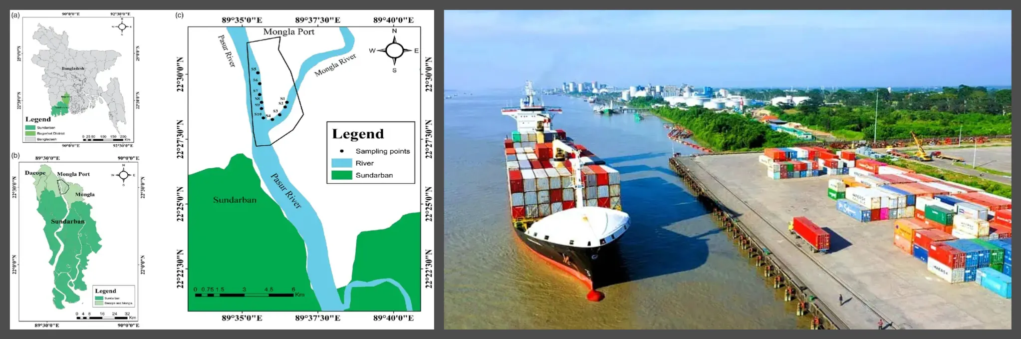
The map showing the Mongla port area (left), and a ship at the Mongla Port (right)
As the second-largest seaport in Bangladesh, Mongla has become an important alternative to Chittagong Port. It is also being developed into a key transit hub for India’s northeastern states, as well as for Bhutan and Nepal.
Recently, the Mongla Port Authority has recorded a significant rise in vessel arrivals and cargo handling during the first seven months of the 2025–26 fiscal year, marking a new milestone in the port's operational performance.
The importance of the under-construction Matarbari Port to Bangladesh, on the other hand, lies in its being the country’s first deep-sea port, and is funded by the Japan International Cooperation Agency (JICA). Having relied on other deep-sea ports in the region, Matarbari has opened a new window for Bangladesh in South Asia.
Major ports in the region, including Colombo, Singapore, and Port Klang in Malaysia, have significantly increased transhipment costs for ships entering or leaving Bangladesh. As a deep-sea port, container ships with deeper drafts will be able to dock directly in Matarbari rather than having to shift to feeder ships to/from the larger regional ports.
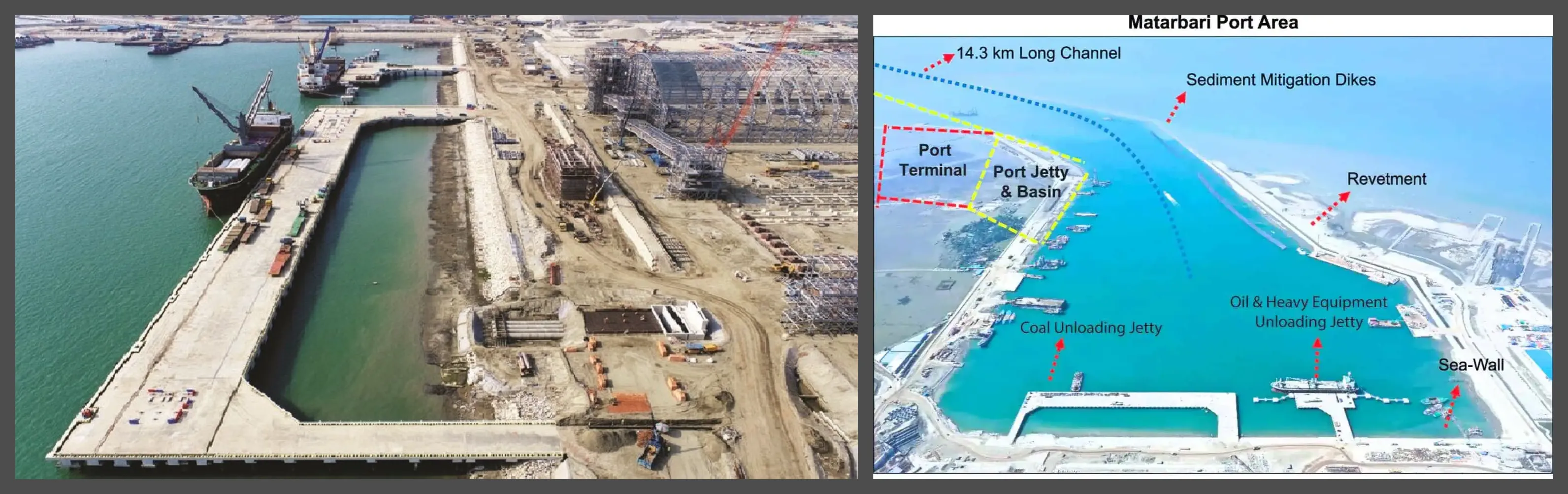
The Matarbari Port (left) and the larger port area (right)
Once operational, Matarbari will be able to handle ships of deeper draft and larger cargo capacity than Chattogram port, which is currently the largest port in Bangladesh.
Additionally, the Payra Port is the third seaport of Bangladesh, located on the bank of the Rabnabad Channel in Patuakhali. As the third major maritime gateway of Bangladesh, Payra Port is a cornerstone of the country's “Vision 2041,” which aims to decentralise maritime trade away from the congested Chittagong and Mongla hubs.
The port is supposed to serve as a key gateway for maritime trade in the region. It also serves as an important transhipment hub for feeder services linking South Asia to Southeast Asia and the rest of the world.
However, being located adjacent to the Sunderbans has raised concerns about the possible loss of biodiversity and habitat degradation in the world’s largest mangrove forest. The intersection between environmental concerns and geopolitical interests is particularly evident here, as port development intensifies pressure on fragile ecosystems.
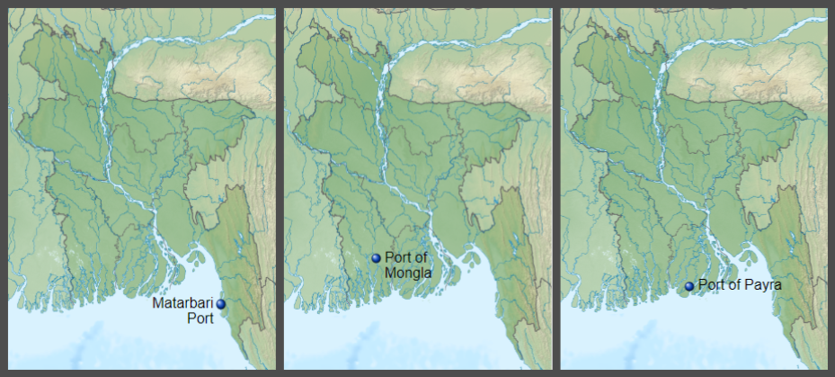
Maps showing locations of the Matarbari, Mongla and Payra ports in Bangladesh
Myanmar
Myanmar acts as a gateway between South and Southeast Asia, with a long coastline on the Bay of Bengal and contiguous land borders with India, China, Thailand, and Laos. It holds critical maritime significance, with 1,200 miles of continuous coastline along the Andaman Sea and the Bay of Bengal.
Thus, Myanmar’s ports form the fulcrum of the region’s maritime shipping routes connecting the Indian and the Pacific oceans.
The Yangon Port is the major gateway for Myanmar, handling around 90 per cent of the country’s international maritime trade. It comprises two harbour areas: Yangon Inner Harbour and Thilawa Outer Harbour, totalling over 40 berths.
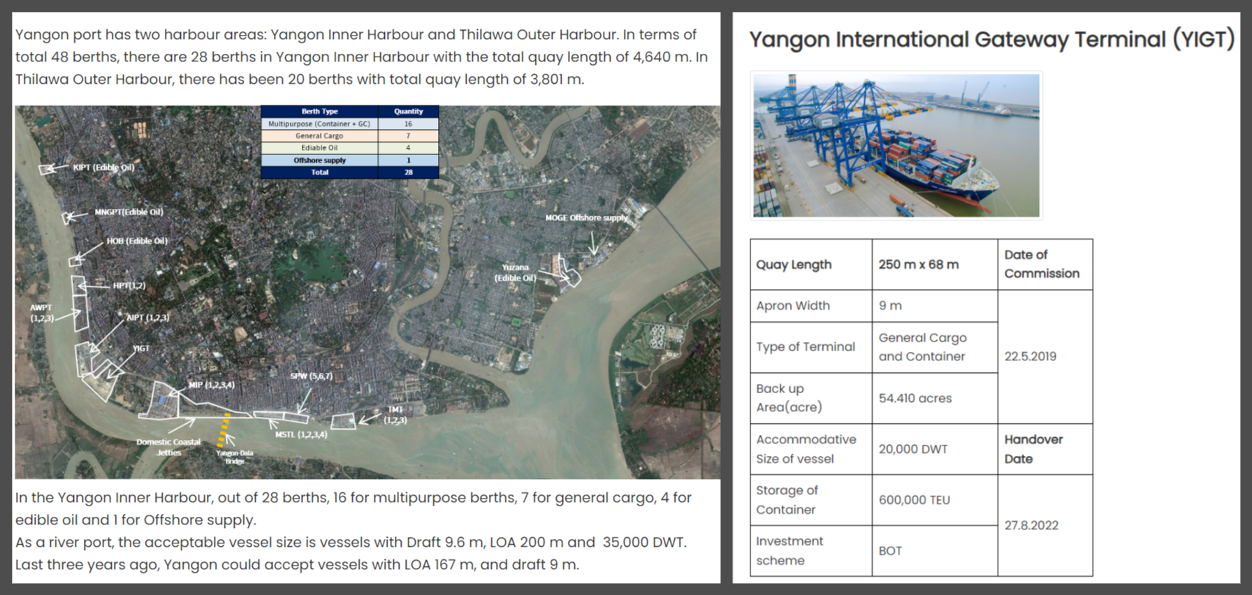
In 2025, the port handled 728 container vessel calls. This year, the port expects over 53 container vessel calls every month. The Yangon port also serves as the main gateway for 95 per cent of Myanmar’s foreign trade via the sea route, mainly with countries in the Bay of Bengal region.
Another major port in Myanmar, which had been of India’s ‘interest’ owing to its strategic location, is the Sittwe Port.
Sittwe Port is a strategic deep-water port located in Myanmar’s Rakhine State on the Kaladan River. The port has been developed under a framework agreement between India and Myanmar and forms a crucial link for India’s Kaladan Multi-Modal Transport Project.
Connectivity in Northeast India, as underpinned by India’s Act East Policy, is closely tied to the Sittwe port. It connects to Paletwa in Myanmar via an inland waterway, and from Paletwa, it is linked to Zorinpui in Mizoram via a road. The northeastern states of Mizoram and Tripura stand to benefit greatly from these connectivity projects.
However, the civil conflict in Myanmar has made the Sittwe port politically volatile, which has caused concerns for the Indian government. The Arakan Army has seized control of 14 townships in the Rakhine province, and seized control of Paletwa in January 2024.
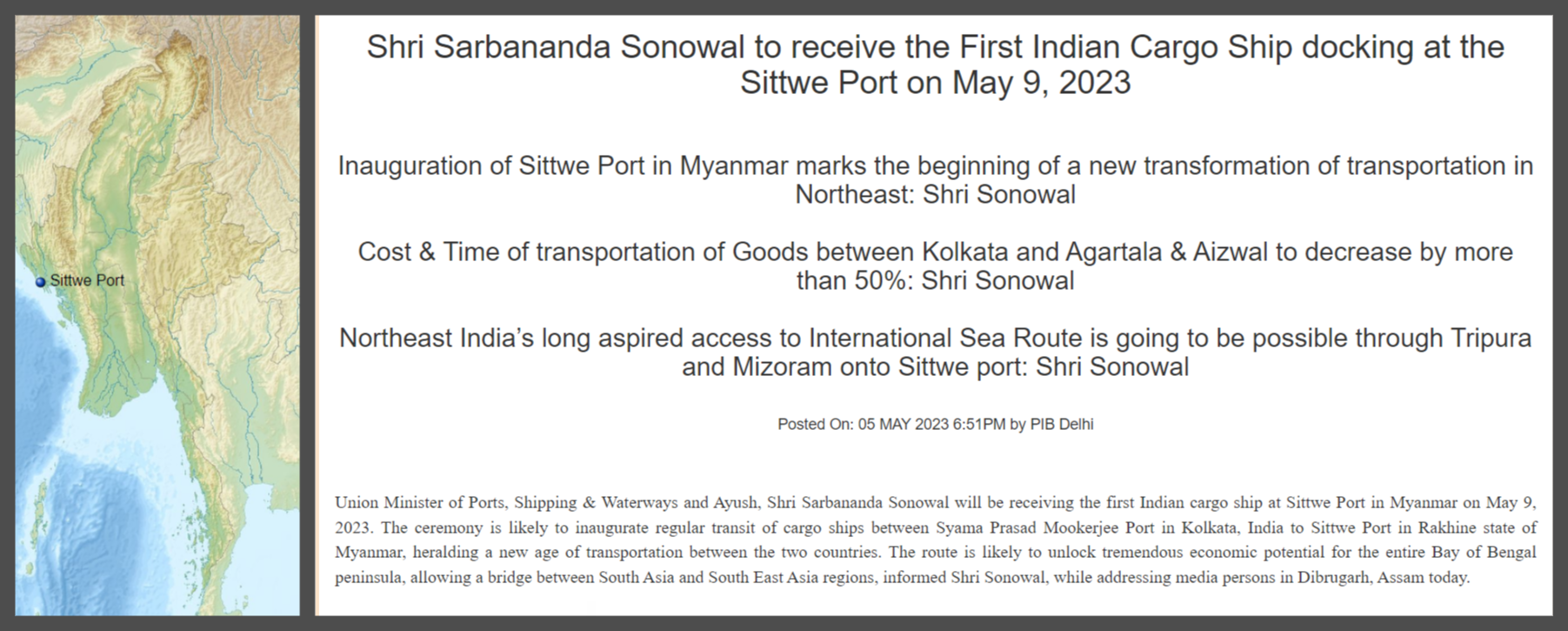
Such a complicated situation has led India to engage with the Myanmar military government on one side and the rebel groups on the other, to safeguard its interests in the Sittwe port.
Another port that has gained immense geopolitical traction in contemporary times is the Kyuakphyu port. The port is a deep-sea port in Rakhine State of Myanmar. The proposed port is a USD 7.3 billion infrastructure project undertaken in collaboration with Chinese state-owned firms.
The project also forms a critical part of China's Belt and Road Initiative (BRI) and the China-Myanmar Economic Corridor (CMEC). China’s backing for the Kyuakphyu project seems to be influenced by its desire to gain direct access to the Indian Ocean, bypassing the Strait of Malacca and reducing its reliance on this critical maritime gateway.
However, India perceives the development of Kyuakphyu with significant apprehension, viewing it as a part of China’s geostrategic encirclement. The presence of the port near India’s eastern strategic frontier and the Andaman and Nicobar Command, which protects vital sea lanes of communication, presents potential threats to India’s security.
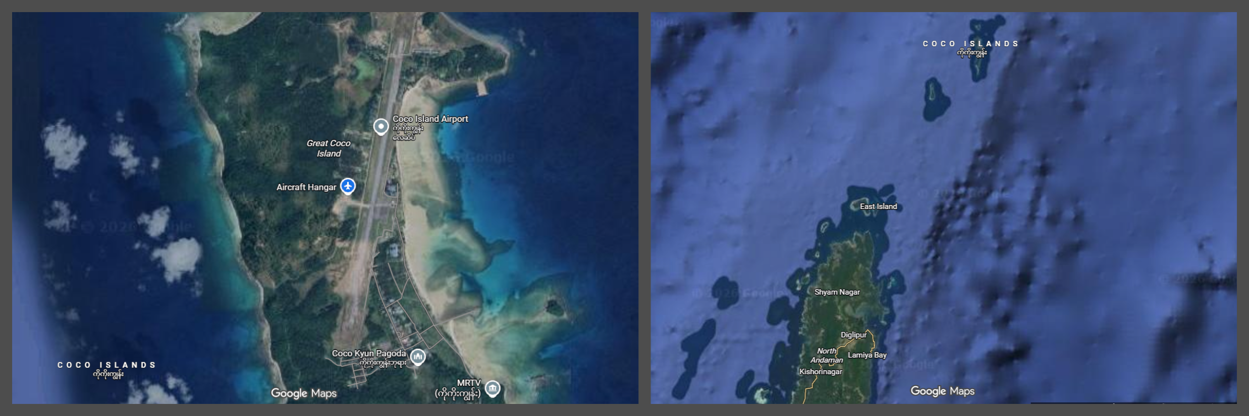
An airstrip in the Coco Islands (left), and the location showing its proximity with Andaman and Nicobar Islands (right)
There are persistent fears expressed in various quarters that the port is likely to be used by the People’s Liberation Army Navy (PLAN) for intelligence-gathering activities. Such concerns are intensified by the growing Chinese footprint in the area. For instance, China has constructed a 2,300-meter runway and radar stations on Myanmar’s Coco Islands, located only 55 km from India’s Andaman Islands.
Another prominent facility is the Thilawa Port, also known as the Myanmar International Terminals Thilawa (MITT). Thilawa is the largest terminal in Myanmar and primarily serves RoRo ships. The terminal is located just 25 kilometres from Yangon, and is adjacent to the Thilawa Special Economic Zone.
The MITT is owned by Hutchison Port Holdings and is managed by Myanmar International Terminal Thilawa, a private company based in Hong Kong.
However, following the human rights crisis stemming from the 2021 coup, the Japanese firms exited the project.
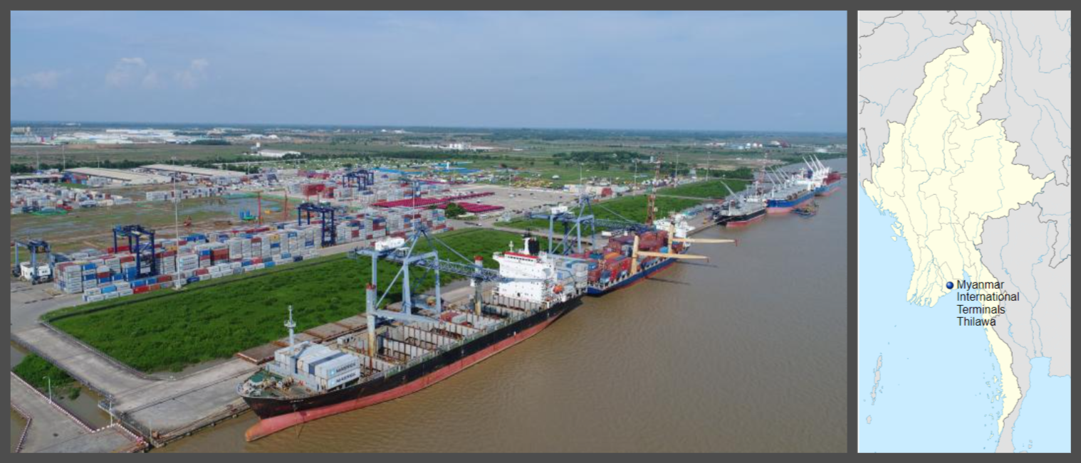
The MITT terminal (left), and its location on the map (right)
India
The Visakhapatnam Port in the state of Andhra Pradesh is known as one of India’s most efficient and advanced maritime centres. The Port was recently ranked among the world’s top 20 container ports.
In 2025–2026, the port plans to handle 90 million tonnes of cargo, using its natural harbour and deep-water berths. As a key part of the Prime Minister’s Gati Shakti initiative, the Visakhapatnam Port has the largest direct rail connectivity for any Indian port, with over 200 kilometres of direct railway track access for easy inland connections.
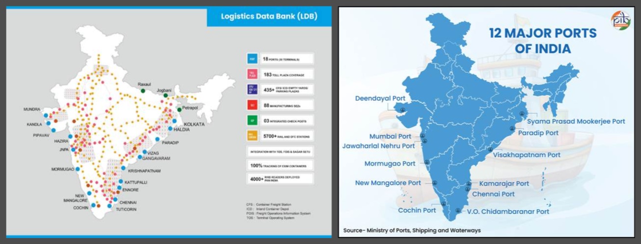
Rail and road network connections various ports under the Gati Shakti (left), and Sagarmala (right) projects
As the port moves to a full 'landlord model' by 2030, it is focusing on lowering logistics costs and working with the Sagarmala programme to stay competitive with nearby private ports.
The planned port in Galathea Bay in south Nicobar of the Andaman and Nicobar archipelago is one of India’s most ambitious plans to create a dual-use civil-military project on one of its most strategically located island territories.
Maritime strategists have likened the Nicobar port to a future Pearl Harbour, the gigantic US naval base on Hawaii. The port at Galathea Bay will be approximately 40 nautical miles from the Malacca Strait, the narrow maritime corridor linking the Indian and Pacific Oceans.
A substantial share of global trade, and a significant proportion of China’s energy imports, passes through this chokepoint. The island’s position on the main east-west international shipping route, roughly equidistant from Colombo, Port Klang of Malaysia, and Singapore, gives India a rare strategic advantage, a vantage point to monitor the vast oceanic expanse, and a critical sea lane.
For decades, Indian transhipment cargo has been routed through the three international ports in Colombo, Singapore and Malaysia. More than 75 per cent of India’s transshipped cargo is currently handled outside the country, with over half routed via Colombo.
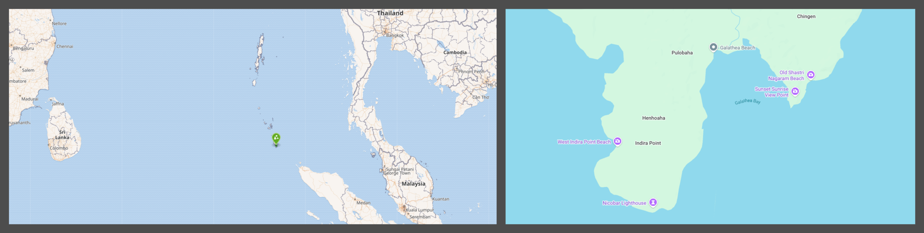
The location of Galathea Bay and its proximity to the Strait of Malacca (left), and being on the bottom tip of Andaman and Nicobar giving India a strategic edge (right)
The Galathea Bay project, thereby, could be a game-changer as the civilian side of the facility is envisaged to be an international container transhipment facility (ICTP). If materialising on these lines, the Galathea Bay ICTP could prove to be a formidable challenger to these three international ports in the region.
Such potential notwithstanding, concerns have been raised against this project, including environmental as well as protection of the indigenous groups in the island.
The Syama Prasad Mookerjee Port (SMP), comprising the Kolkata Dock System and the Haldia Dock Complex, remains the main maritime gateway for Eastern India and landlocked countries such as Nepal and Bhutan.
Even though the shallow Hooghly River has posed challenges, the port has made improvements, including its first night-time container vessel arrival in February 2026. The port’s importance is also shown by its move to a “landlord port” model, aimed at public-private partnership to boost efficiency and serve as a hub for inland waterway connections through National Waterway-1.
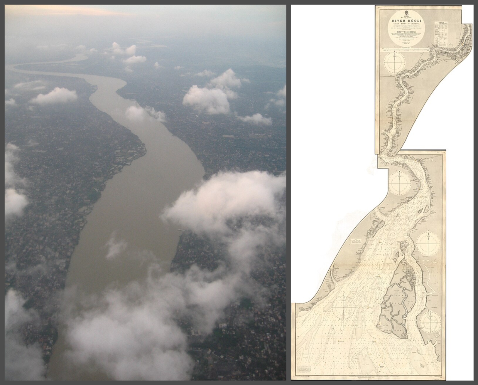
Aerial view of the Hooghly River in Kolkata (left), a nautical chart published by the UK Hydrographic Office in 1905 showing the Hooghly River from Sagar Point to Kolkata (right); photo sources - Wikimedia Commons
The Sagar Port was first proposed as an alternative to Kolkata Port, which requires extensive dredging and is located on Sagar Island, with a natural depth of 10.5 meters. Even though the project faced questions following the Tajpur Port plan, it remains a key part of the Union Government’s plans through the Bhor Sagar Port Limited (BSPL) initiative.
The plan includes building a large road and rail bridge over the Muriganga River to link the island to the mainland. The Sagar Port is meant to handle up to 60 million tonnes of bulk cargo, acting as a backup deep-water port to ease the load on current river ports.
The Gopalpur Port, situated in the Ganjam district of Odisha and currently owned and operated by Adani Ports and SEZs, has rapidly evolved from a seasonal anchorage into a sophisticated, all-weather deep-sea facility.
In addition, Gopalpur was operationalised as India's first Port of Refuge on the east coast. This designation makes it a critical safety hub for vessels in the Bay of Bengal, providing a specialised location for ships in distress to seek shelter, stabilise cargo, and prevent environmental disasters.
The Tajpur Deep Sea Port, in West Bengal’s Purba Medinipur district, will be the state’s first deep-sea port that could host the large ships unable to reach Kolkata or Haldia. With a planned draft of 16 to 18 meters, Tajpur was hoping to win back trade now going to Odisha’s ports.
As of early 2026, the project is in a new global tender process after earlier delays, and the government has set aside another 1,000 acres to help build an industrial area. Once finished, the port will be the sea end of the Amritsar-Kolkata Industrial Corridor, greatly boosting exports of minerals, coal, and iron ore from eastern India.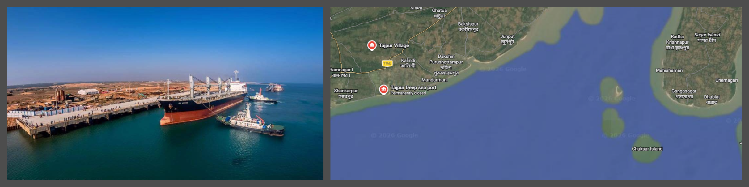 A view of the Gopalpur port published by the Odisha government (left), and location showing Tajpur near the point where the Hooghly river meets the Bay of Bengal
The Ranong Port in Thailand is operated by the Port Authority of Thailand (PAT) and is located in the province of Ranong on Thailand’s southern coast.
It is the entry point for trade moving along Thailand’s Andaman Sea coast from all major global trade routes to/from South Asia, the Middle East, Africa, and Europe, as well as BIMSTEC countries (India, Myanmar, Bangladesh, and Sri Lanka).
The port plays an integral role in regional economic development by providing access to substantial amounts of seafood and the fishing industry, given its location near rich fishing grounds.
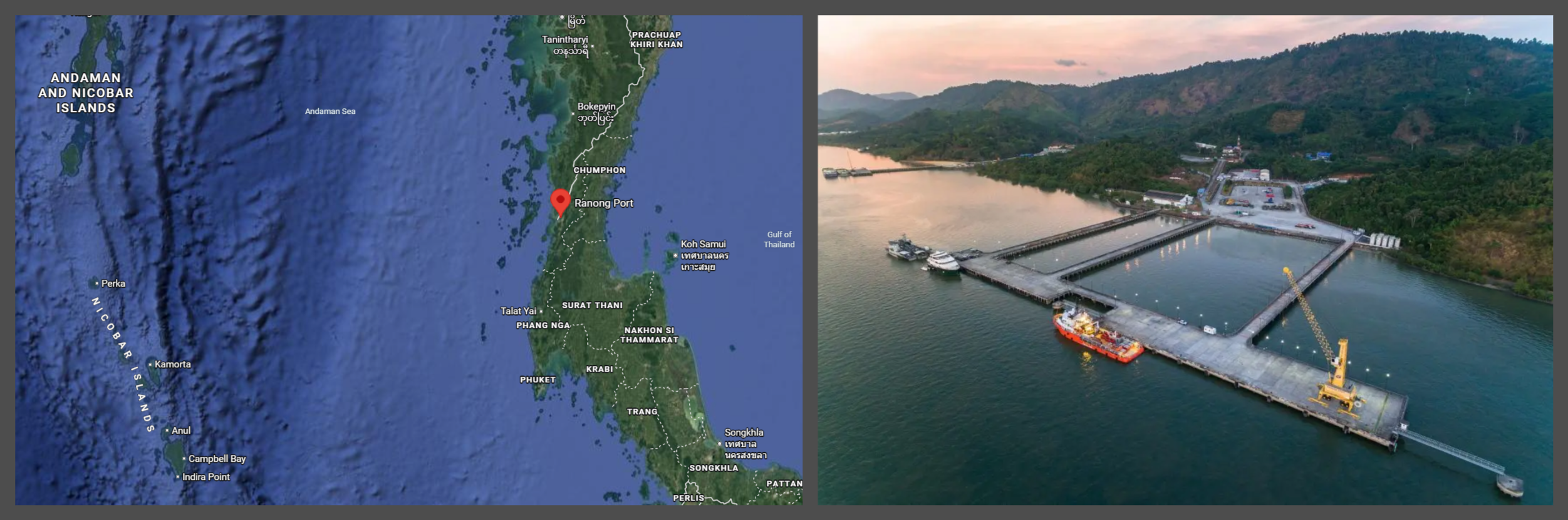
The location of Ranong Port on the map (left), and an aerial view of the port (right)
The Port Authority of Thailand has also initiated a Multimodal Transport Project that combines five economic corridors: from China to Thailand and Laos; from Myanmar to Thailand; and to/from the BIMSTEC countries, to improve trade and logistics connectivity.
This has increased in importance since civil unrest has affected Myanmar, and land traffic at major crossings to/from Thailand (e.g., Mae Sot and Mae Sai) has shifted to sea traffic to/from Ranong.
Indonesia
The Sabang Port, located on Weh Island at the northern tip of Sumatra, is a vital maritime gateway for Indonesia and a focal point of geopolitical interest in the Indo-Pacific. The port occupies one of the most critical maritime positions in the world as it serves as the north-western entry point to the Malacca Strait.
The Port has thus emerged as a port with profound implications for the stability and prosperity of the broader Bay of Bengal and Indo-Pacific regions. The port is also designated a Free Trade Zone (FTZ) and a Free Port, meaning it is exempt from customary trade restrictions, import duties, VAT, and luxury goods.
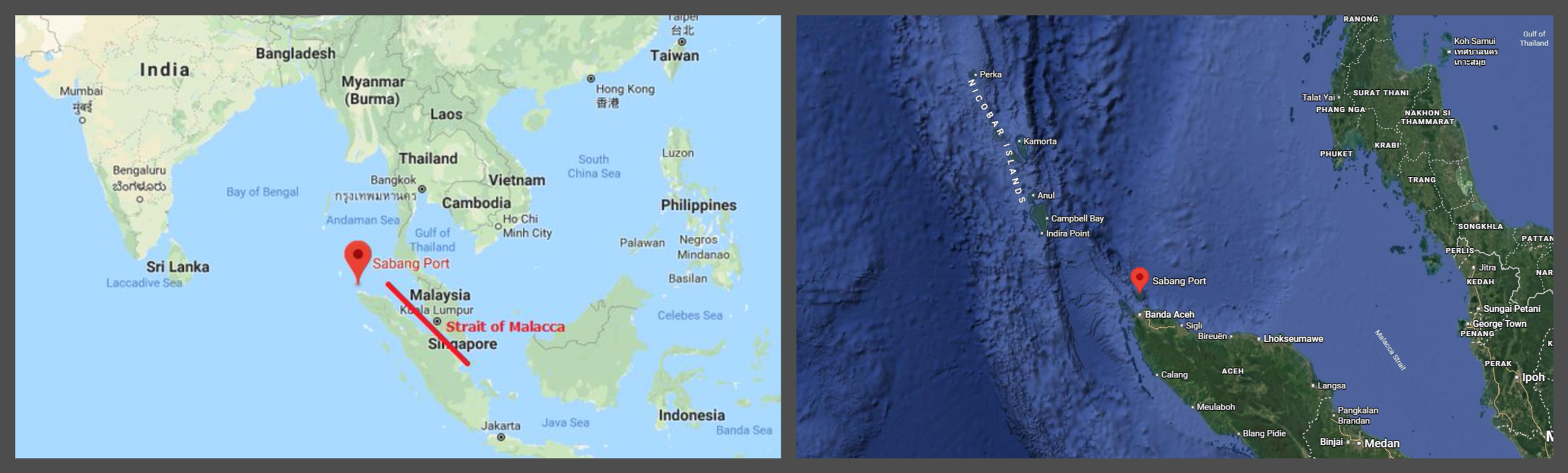
Maps showing the location of Sabang port at the mouth of the Strait of Malacca and just miles away from Indira Point in Greater Nicobar Island
The great power competition over the Bay of Bengal
Due to its economic potential and strategic importance, the Bay of Bengal has become a hot spot for the great powers.
China has built a substantial footprint in the region over the past few years. The Kyaukphyu Deep Sea Port (located in Myanmar), which provides Beijing with a direct energy pipeline and trade corridor to Yunnan province, effectively circumvents the heavily insured Malacca Strait.
Further south, the Hambantota Port in Sri Lanka, under a 99-year lease, represents a permanent logistical footprint.
Although China’s investment in the Chittagong Port (Bangladesh) and the Payra Port (Bangladesh) is primarily economic, analysts believe they could also become secondary ‘strategic nodes’ that could be incorporated into a broader maritime network, often called “String of Pearls 2.0.”
The concept of “String of Pearls 2.0” extends this idea, suggesting a new phase of deeper, more interconnected Chinese involvement in the region's ports and maritime infrastructure, potentially with greater strategic and security implications.
To mitigate the risk of encirclement around its borders by hostile regional powers, India has established a policy of securing port access across the southeastern coastal states of Asia to secure critical sea-lane supply routes. Recently, India agreed to develop a cargo terminal at Mongla, a port in Bangladesh, as part of this larger strategy to establish port access in southeastern Asia.
Similarly, the Sittwe Port in Myanmar allows India to connect with its landlocked northeastern provinces, as well as by the development of coastal radar surveillance capabilities to monitor Bangladesh's coastline more effectively.
India planned to construct a container terminal in Yangon, Myanmar, through the agreement between Adani Ports and the Myanmar Economic Cooperation Company (MEC), a United Nations-designated entity controlled by the Myanmar junta.
However, following the military coup in Myanmar in February 2021, Adani Ports discontinued the project due to sanctions imposed by the US and UK governments against all firms controlled by the military junta.
The Maritime Transport Cooperation-India Bangladesh Coastal Shipping Agreement (2026) is one recent initiative aimed at creating an integrated multimodal corridor for cargo shipments from Indian ports on the eastern coast (like Visakhapatnam and Paradip) to major Bangladeshi cargo-handling ports like Chittagong and Mongla.
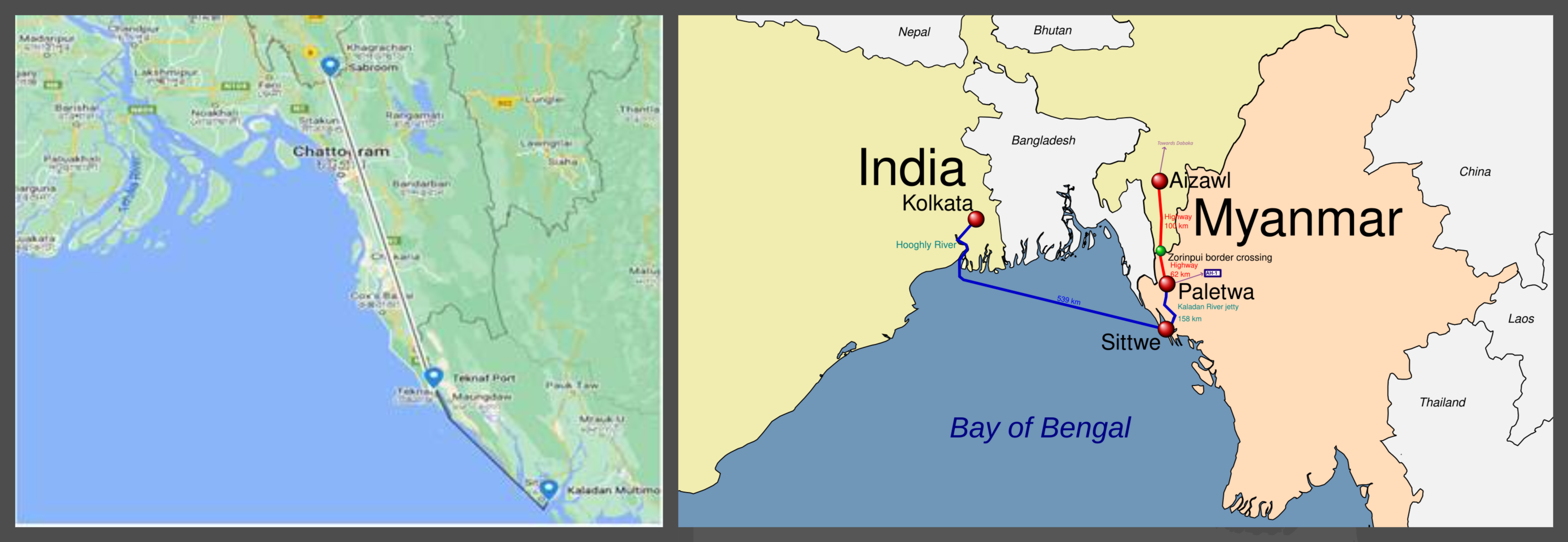
Maps depicting the Kaladan Multimodal scheme and the larger BIMSTEC connectivity architecture
In addition, the Bay of Bengal Initiative for Multi-Sectoral Technical and Economic Cooperation (BIMSTEC) has established a structure to integrate the economies of member countries and created an institutional framework to facilitate harmonised maritime transport by establishing an integrated economic zone in the Bay of Bengal comparable to the Mediterranean Sea.
To respond to rising demand, port modernisation has received significant investment. Numerous changes to improve port-led development have been identified by India’s Maritime Ports Strategy (2030) and the Sagarmala Programme.
Moreover, the Galathea Bay development in Great Nicobar Island aims to increase the domestic handling of Indian Goods from 25 to 75 per cent by 2030. With changes such as these, along with the establishment of new ports (such as Matarbari in Bangladesh), the Bay of Bengal is slated to transform into a world-class maritime logistics ecosystem.
Japan is the leading investment partner, leading through the “Bay of Bengal (BIG-B)” Project, in the formation of a regional industrial base. In particular, Japan is developing the Matarbari Deep Sea Port in Bangladesh to serve as a regional transhipment hub for India, Nepal, and Bhutan.
The preference for Japan as an investment partner is not just driven by its declared policy for a ‘free and open Indo-Pacific’ region but also underpinned by the fact that investments by countries like China have resulted in heavy debt for the developing countries, especially the ones associated with China’s BRI projects.
Additionally, the partnership known as the 'Quad Ports of the Future Partnership' has been kicked off by the US and its Quad partners; however, it will focus on mobilising private sector investment to create clear and resilient port infrastructure that does not allow for any one external power to monopolise any of the regional trade routes.
Bay of Bengal as the ‘strategic’ maritime theatre
Nowadays, the ports in the Bay of Bengal cannot be viewed simply as links in regional commerce. Rather, they have assumed crucial geostrategic importance in an increasingly contested Indo-Pacific.
Their significance is amplified by their proximity and connectivity to vital maritime chokepoints, such as the Strait of Malacca, while recent developments in the Strait of Hormuz highlight how these maritime corridors remain vulnerable to geopolitical shocks and turbulence.
In this context, ports in India, Bangladesh, Myanmar, Thailand, and Indonesia must engage in broader strategic calculations that extend beyond trade and logistics.

Further, the growing involvement of major powers such as China, India, and Japan is an indication that their investments in ports, maritime infrastructure, and connectivity projects, though economic in character, reflect attempts at strategic positioning.
Finally, the Bay of Bengal’s port networks reveal an important pattern – where local and regional development aspirations seem to confront global power rivalries. As maritime geopolitics gain traction, these ports have immense potential to play a decisive role in shaping connectivity, commerce, and the balance of power in the wider Indo-Pacific.
(Views expressed in this report are the authors' own.)
Follow us on WhatsApp
Follow us on Facebook
Follow us on X @vudmedia
Follow us on Substack


